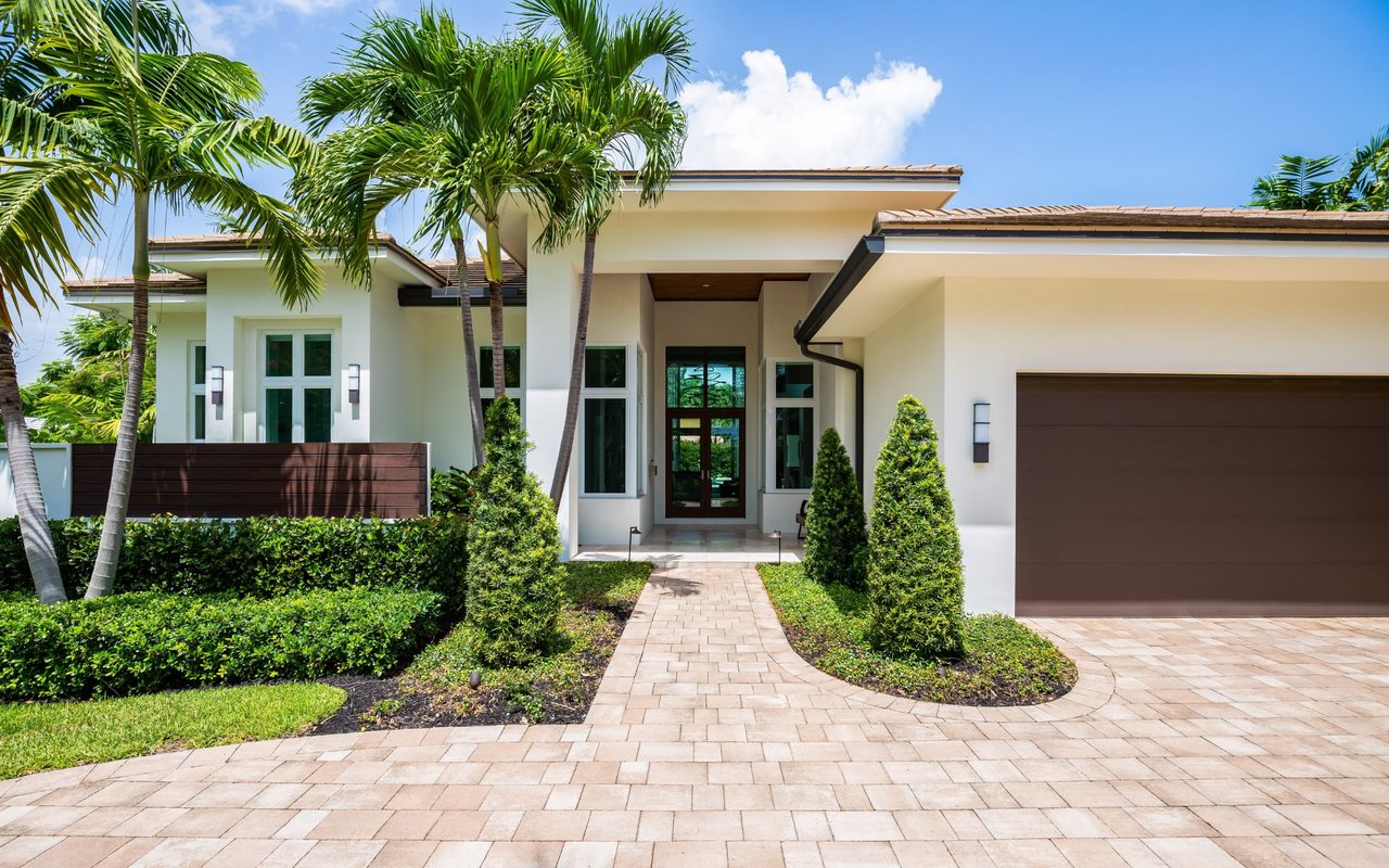
Picture your morning coffee on a quiet dock, osprey overhead and gentle ripples on the Banana River. Buying waterfront on Merritt Island can deliver that lifestyle, but details like boating access, dock rules, flood zones, and insurance shape your experience and budget. In this guide, you’ll learn how to evaluate location, confirm access, understand permits, and plan inspections with confidence. Let’s dive in.
Waterways and Access Basics
Merritt Island sits between the Indian River to the west and the Banana River to the east, with canals and creeks like Sykes Creek connecting many neighborhoods. These waters are part of the Indian River Lagoon system, which is estuarine and brackish, not open ocean. That difference affects wave energy, salinity, and boating conditions. You can review the island’s water features and context on the local overview of Merritt Island geography.
Access to the ocean is shaped by the Canaveral Barge Canal and the Canaveral Lock at Port Canaveral. West of the lock, some reaches behave like nearly non‑tidal estuarine channels, which can influence dock design and lift heights. If ocean runs or the Intracoastal Waterway are important to you, confirm whether a property offers direct ocean access, ICW access, or canal/lagoon only. The U.S. Army Corps reference on Canaveral Harbor explains the local tidal context and non‑tidal reaches west of the lock.
When you plan your routes, note posted slow‑speed zones and wildlife protections. Portions of the lagoon are manatee areas with speed limits that can affect travel time and boating style. Review local boating and fishing guidance from the Merritt Island National Wildlife Refuge.
Dock Rules and Permits
Brevard County dock limits
Brevard County regulates residential docks and piers with clear, measurable standards. Common limits include:
- Side setback: 7.5 feet from the side property line (projected into the water).
- Projection into manmade waterways: The lesser of 20% of the waterway width or 30 feet, including pilings.
- Deck area: Generally limited to 400 square feet for dock/pier/deck; roofed slips and combined roof+deck have separate caps.
- Boathouses: Specifically regulated and may be prohibited in certain canals or easements.
- As‑built survey: Required after construction to verify setbacks and compliance.
You can read the full standards in Brevard County’s code section for residential boat docks and piers.
State and federal approvals
Work in or over Florida’s waters can require state and federal sign‑offs. The Florida Department of Environmental Protection regulates dredge and fill activities under the Environmental Resource Permit program and may require a proprietary authorization when you occupy sovereign submerged lands. Learn more about ERP and submerged lands on the Florida DEP overview.
The U.S. Army Corps of Engineers may also require a federal permit for docks, boathouses, dredging, or excavation. In practice, local authorities often expect state and federal approvals to be in hand before issuing county building permits. Brevard’s code references these requirements in the county’s dock and pier standards.
Check existing structures
If you are buying a home with a dock or seawall, ask for copies of original permits and any final as‑built survey. If a structure was built without proper permits, an owner may be required to remove it, modify it, or apply for after‑the‑fact approvals. Start with the county’s guidance on Residential Marine Construction permits.
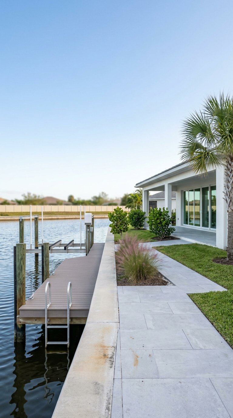
Dock Types and Design
Common configurations you will see
On Merritt Island, you will encounter fixed pile‑supported docks and floating docks. T‑docks, L‑docks, and finger piers are standard layouts for single‑family homes. Boat lifts and PWC lifts are common additions. Covered slips and boathouses face extra rules and may not be allowed in some canals. A Florida waterfront permitting guide explains these options in plain language in its dock and lift overview.
Depth and layout drivers
Your boat’s size and draft drive the design. Verify water depth at mean low water and channel clearance rather than relying on a “deep water” claim. Depth can vary over short distances and with seasons. In reaches west of the Canaveral Lock, tidal range can be small, which may change ideal deck heights or air gaps for lifts; consider a site‑specific marine survey.
Environmental Factors and Wildlife
The Indian River Lagoon has active restoration projects through Brevard County’s Save Our Indian River Lagoon program. Septic‑to‑sewer conversions, stormwater retrofits, muck removal, and living shoreline work can influence future permits and potential homeowner projects. You can explore program context and project types through the Save Our Indian River Lagoon program page.
Regulators review seagrass shading and propeller scarring risks. Living shorelines that use oysters or marsh plants are often favored in restoration areas, while hard seawalls may face closer review. Expect speed‑limited zones in manatee areas and follow posted rules that could affect boating and certain structure footprints near sensitive habitat.
Views, Orientation and Outdoor Living
Waterfront orientation changes the daily feel of a home. East‑facing yards capture sunrise light and calmer morning winds over the lagoon. West‑facing backyards deliver sunset views that many owners prize for evening outdoor time. During showings, step onto the dock at different times of day to test light, wind, and privacy.
Vegetation matters. Mangroves and shoreline plants can add privacy and stabilize banks but are protected, which can limit where and how you build. Also confirm whether existing dock or walkway footprints constrain future patios, pergolas, or outdoor kitchens under local setbacks.
Flood and Insurance Basics
Flood maps and elevation
Waterfront homes often sit in Special Flood Hazard Areas where lenders require flood insurance. Check the property’s FIRMs at FEMA’s Flood Map Service Center and ask for any existing Elevation Certificate. Elevation data can materially change premiums.
Wind and hurricane deductibles
Florida policies usually include a separate hurricane or named‑storm deductible, often set as a percentage of dwelling coverage. Ask your insurance agent to explain when it applies and how it is calculated. The Florida CFO’s consumer page explains the basics of hurricane deductibles.
Docks, lifts, and seawalls
Coverage for docks, boat lifts, and seawalls varies by policy. Some homeowners policies include “other structures” limits that apply to docks, while lifts and vessels may need separate endorsements or marine policies. A practical permitting guide highlights the importance of quoting the whole picture — house, dock, lift, and flood — when you budget for ownership, as outlined in this Florida dock and lift guide.
Buyer Checklist
- Confirm your exact waterbody and access type: ocean via the Canaveral Lock, ICW, lagoon, or canal.
- Ask for recorded permits and the as‑built survey for any dock, seawall, or bulkhead; keep copies with your closing documents.
- Order a local marine survey for depth at mean low water and a structural review of the dock and seawall.
- Check FEMA flood maps for the parcel and request any Elevation Certificate; get flood quotes from NFIP and private markets.
- Ask your insurance agent how hurricane or named‑storm deductibles work and whether the dock, seawall, and lifts are covered.
- Verify septic vs. sewer and any local septic‑to‑sewer upgrade obligations in your sub‑basin.
- If you plan to expand or change the dock, review county setback and area rules and find out if state or federal approvals will be required before county permits.
Your Waterfront Team
Consider lining up a few specialists early:
- A licensed marine contractor to inspect dock, lift, and seawall conditions and advise on permitting.
- A licensed surveyor/engineer to confirm boundaries, prepare or update the as‑built, and complete any Elevation Certificate.
- A coastal or marine survey for water depth and navigational clearance checks.
- A Florida‑experienced insurance agent to price home, flood, and any dock/lift or boat coverage.
- A county permitting contact for pre‑application questions, especially if you anticipate repairs or expansions.
Ready to find your waterfront fit?
When you are ready to explore Merritt Island’s waterfront, bring a clear plan for access, permits, and insurance. We will help you evaluate depth, route your boating days, and review dock paperwork so you can buy with confidence and enjoy the lifestyle from day one. Connect with LGN Group - Ann LeNoir to tour on‑market options and craft a smart, design‑forward plan for your new waterfront home.
FAQs
Do Merritt Island canal homes have ocean access?
- Some do via the Canaveral Barge Canal and Canaveral Lock, but routes, slow‑speed zones, and water depth vary by location, so verify the exact path and constraints before you buy.
What are Brevard County’s basic dock size limits?
- Side setbacks are 7.5 feet; projection into manmade waterways is the lesser of 20% of width or 30 feet; and dock/pier/deck area is generally limited to 400 square feet, with separate caps for roofed slips.
How can I confirm a dock was properly permitted?
- Ask the seller for original permits and the final as‑built survey, then review county records; unpermitted docks may require modification, removal, or after‑the‑fact permits.
Are manatee and slow‑speed zones a factor for owners?
- Yes; posted protections can limit speed and influence travel times or structure footprints near sensitive habitat, so check local rules for your immediate area.
What flood documents should I request during due diligence?
- Get the property’s FEMA flood map panel and any Elevation Certificate; both inform whether flood insurance is required and how policies are rated.
Do I need state or federal approvals to modify a dock?
- Many projects require Florida DEP authorization and may need a U.S. Army Corps permit; county building permits often follow after those approvals are in place.